Schöner's Cosmographical Miscellany and His Annotations in the Waldseemüller Sammelband
In 1656 the Emperor Ferdinand III of Austria purchased the Library of Georg Fugger for the Hofbibliothek in Vienna. The collection included the Library of Johannes Schöner and was handed down by Fugger to his son (Phillip Eduard, 1546-1618) and his great-grandson (Albert III, 1624-1682). Besides Schöner's Library Fugger's collection also contained the best mathematical and scientific literature then available.
 Portrait of Schöner
The codex containing the 1507 and 1516 World Maps by Martin Waldseemüller was once part of this collection but how and when it became separated from Schöner's original Library and made its way to the Wolfegg Castle in Wurttemberg where it was discovered by Joseph Fischer in 1901 remains an historical mystery. The Waldseemüller Sammelband contained additional items besides the two famous world maps and originally included a set of Celestial Gores by Schöner and the star-chart of Stabius as rendered by Albrecht Dürer. Only one of the star-charts was bound into the codex and it shows the stars visible in the southern hemisphere. The figure below shows Schöner's annotations on the chart.

Contained in Schöner's Library that now resides in the Austrian National Library in Vienna are several volumes that resemble the Waldseemüller Sammelband in that they are bound in the same manner with heavy wooden covers connected with leather backs and also display Schöner's bookplate. These volumes include Schöner's copy of the 1482 Ulm edition of Ptolemy and his copy of Waldseemüller's 1513 edition of the same book. Both books are annotated with the same red-lines found on the 1507 and 1516 World maps and are held into the volumes with slices of printed vellum globe gores and pieces of the Elinger Map.

Schöner's Vellum Manuscript Drawing of a Sheet from the 1516 Carta Marina
Also included in of Schöner's Library is an interesting cosmographical miscellany that is unpublished but holds a great deal of interest for historians of cartography. The miscellany bares the title "Cosmographia" and contains the following items:
1. A short treatise with title "Regionum sive civitatum distantae."
2. Tables of latitudes and longitudes that are similar in content and structure to the so-called University Tables.
3. Notes on various units used to measure distance.
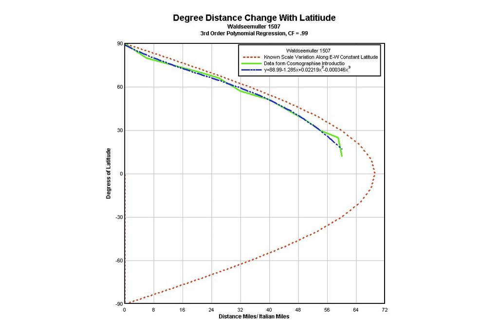
4. A table that displays the number of miles in a degree of longitude for each parallel similar to that found in Waldseemüller and Ringmann's Cosmographiae Introductio.
5. Instructions for measuring the distances between two cities on a map that has coordinates.
6. The University Coordinate Tables.
7. The Tabula Regionum of Regiomontanus. This is of course not the only Regiomontanus in Schöner's Library. Schöner inherited Regiomonanus' manuscripts and published his very important work On Triangles.
8. An outline for the chapter headings of an incomplete work on Cosmography.
9. Excerpts from the Geographiae.
The most interesting of all these works is the Regionum sive Civitatum. The treatise begins by describing at set of instructions for constructing a terrestrial globe. The initial part of the text describes the process by which one inscribes on a globe the locations of the cities and regions on the earth. The first set divides the earth into four equal areas by means of two arcs that intersect each other at ninety degree angles. Once these circles have been inscribed on the globe another great circle is drawn that bisects the other two and forms the equator. The next step divides that part of the equator that lies along the "habitable" part of the earth into 180 degrees of longitude numbering them in units of five. For marking the globe with latitude lines a strip of heavy vellum is used, equal in length to the distance from the pole to the equator. This type of construction continues in the various regions until the whole surface of the globe has coordinates. In order to transpose the points and locations of cities and regions from the globe to a plane the method is essentially that of an azimuthal projection from any point on the surface of the earth. At first the globe-maker selects the city or point that he wishes to make the center of the projected map. Then with a compass he inscribes a circle on the surface of the globe that is large enough in diameter to include the area to be reproduced. The smaller the circle, the larger the scale of the resulting map and the greater ease involved in measuring distances. The second method described in the book outlines what appears to be a conic projection. To do this two new vellum strips are used equal in length to the diameter of the circle drawn on the surface of the globe. The strips are divided into the same number of degrees as the strips used in the first method. They are them placed tangentially along the circle, running north to south. The text says that this method can be used either on a square (quadratam) or a circler (rotundam) map. All this is simply to suggest that Schöner was experimenting a great deal with different methods for measuring distances and for transferring coordinates from maps to globes and vise versa and obviously drew his annotations on the 1507 and 1516 World maps by Waldseemüller for this purpose.